Doghole Port: Duncan's Landing
Sonoma Coast State Park
Duncan’s Landing has a long and diverse history of Native American habitation that began as early as 9,000 years ago. Usage of this area as a seasonal encampment stands in stark contrast to the Euro-American industrial development that took place on the same spot during a few short decades at the end of the nineteenth century. Lumbering operations converted the point and its sheltered cove into a transshipment point for the lumber products created at Duncan’s Mill on the Russian River. While the Russian River is one of the largest rivers emptying into the ocean along the Sonoma Coast, it is not navigable to lumber carrying vessels. Approximately three miles south along the coast from Duncan’s Mill, Duncan’s Landing was the closest embayment suitable for waterborne lumber shipment. Numerous small coasting vessels called at Duncan’s Landing to carry the mill’s production to San Francisco. An 1876 map of the area shows two lumber chutes extending into the cove from the headland. By 1889, a long-distance railroad connected Duncan’s Landing to inland markets eliminating the need for shipment via water.
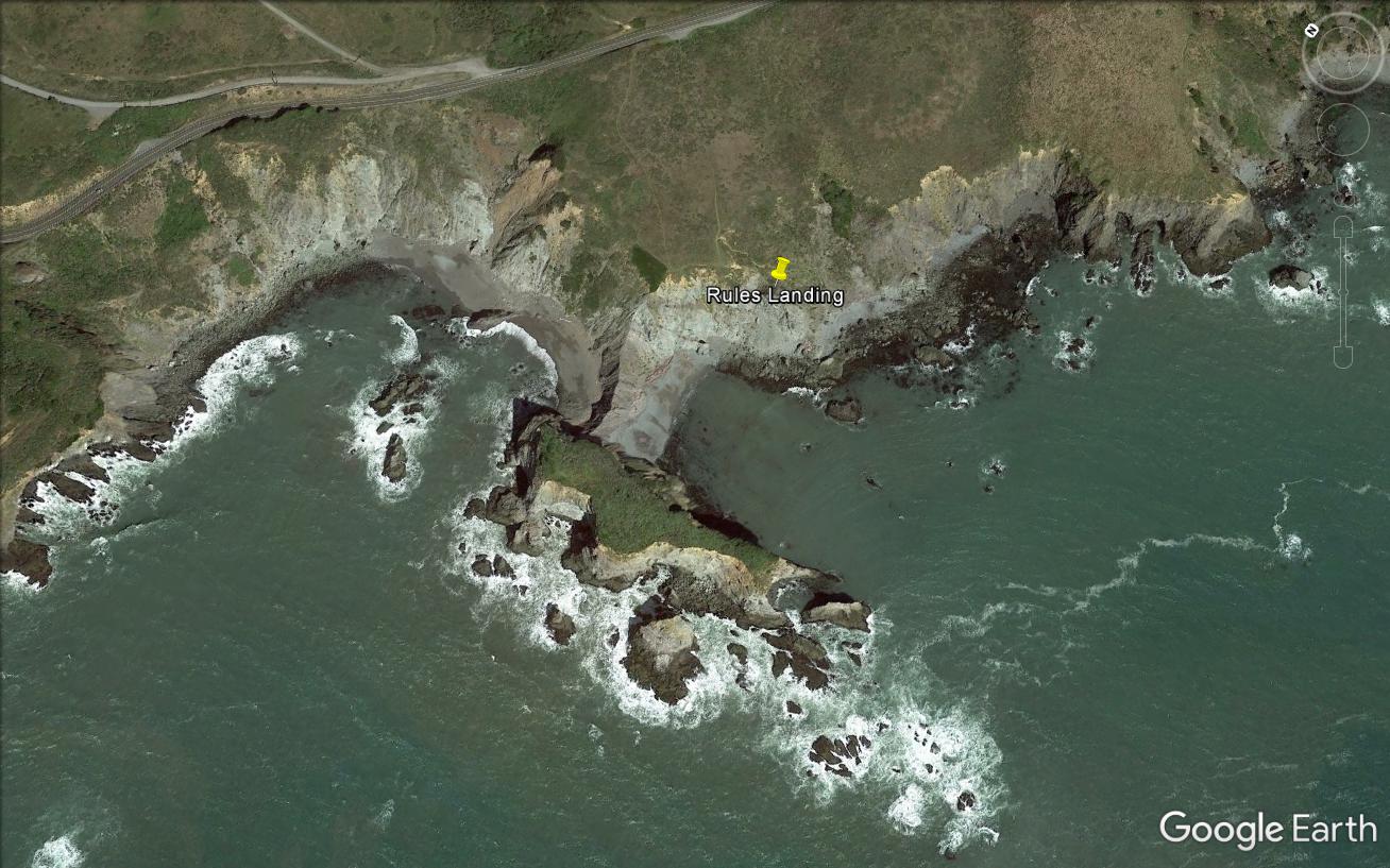
Duncan’s Landing is now part of Sonoma Coast State Park with a scenic turnout from Highway 1 circling the bluff. During the 2016 Sonoma Coast Doghole Ports Project, team members documented the archaeological remains present there to interpret the area’s connection to the lumber industry. The cliffside contained a large number of iron fittings such as eye bolts, chain, and pins used to secure the lumber chutes to the rocky shore. Additionally, archaeologists located evidence of the railway system on top of the headland that carried the milled lumber to the chutes.
Divers conducted an underwater survey of Duncan’s Landing to locate evidence of the mooring anchors employed to keep vessels positioned under the lumber chute ends. The U.S. Coast and Geodetic Survey’s 1876 T-sheet indicated that four moorings were in use at the landing, two located off the lumber chutes and two slightly outside the cove in deeper water. No anchors or other artifacts were discovered underwater by the project team.
-- Deborah Marx, Maritime Archaeologist, Maritime Heritage Program, Office of National Marine Sanctuaries
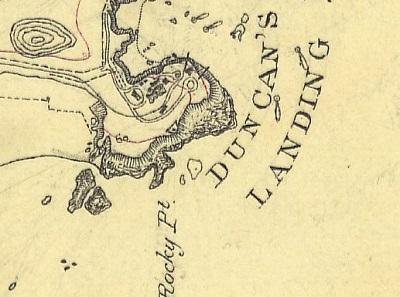
The U.S. Coast and Geodetic Survey T-sheet from 1876 depicts two lumber chutes at Duncan’s Landing.
Credit: NOAA’s Historical Map & Chart Collection
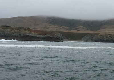
Large wash rocks at the cove’s mouth made it difficult for sail-powered craft to navigate into and out of the doghole port.
Credit: NOAA ONMS and California State Parks
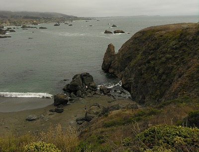
Looking down into Duncan’s Landing where coasting vessels would moor to load lumber.
Credit: James P. Delgado, NOAA ONMS
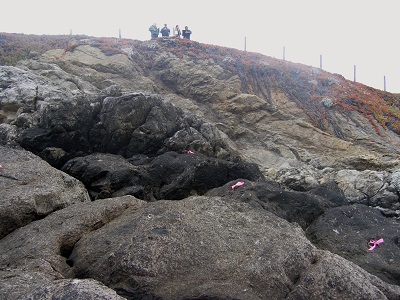
Three iron pins, marked with pink flagging tape, secured cables that supported the lumber chutes.
Credit: NOAA ONMS and California State Parks
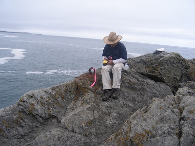
CA State Parks archaeologist Scott Green records the location of an eye bolt at Duncan’s Landing.
Credit: NOAA ONMS and California State ParksCollection

The survey team systematically searched the doghole port for both land and underwater remnants from the port.
Credit: NOAA ONMS and California State Parks