Rocky Intertidal Monitoring at the South Farallon Islands
The Farallones marine sanctuary has conducted long-term monitoring of the rocky intertidal habitats of the Farallon Islands since 1992. The sanctuary is contiguous with the Farallon National Wildlife Refuge at the mean-high tide, and works collaboratively with the refuge to characterize and map the island's wildlife. Data collected include percent cover of areas with algae and invertebrates; their density and species inventories. Surveys are conducted annually during the late summer (August); fall (November) and winter (February) months to avoid wildlife disturbance. The teams strive to collect as much and as consistent data as possible despite unfavorable weather, tides and decreased funding, which have caused data gaps in recent years.
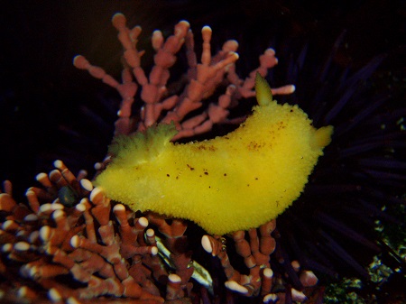
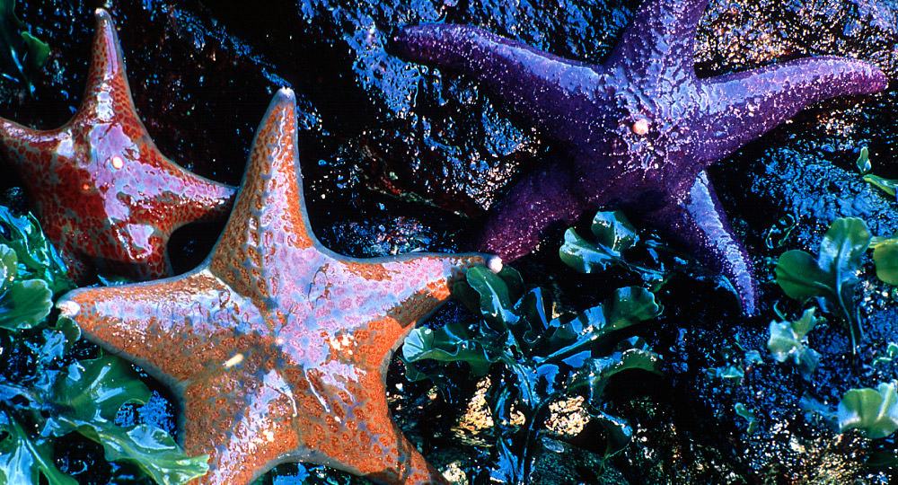
The rocky intertidal areas on the Farallon Islands are predominated with red-turf and coralline algae. The most common algae at the Farallon Islands include encrusting pink algae (Corallina and crustose corallines), red and green turf and "leaf-like" algae such as Cryptopleura, Egregia, Endocladia, Gastroclonium, Gelidium, Mastocarpus, Mazzaella, Neorhodomela, tar-spot algae (petrocelis), Prionitis, Ulva, and invertebrates such as green and colony anemones (Anthopleura), and California mussels (Mytilus). The intertidal areas of the islands are highly productive and diverse. Over 200 species have been found, of which 5 were rare, and 7 were extended ranges. The mean annual percent cover for algae and sessile macroinvertebrates at the South Farallon Islands ranges from 148-255%. Read the publication, Status and Trends of the Rocky Intertidal Community of the Farallon Islands (PDF, 3.6Mb)
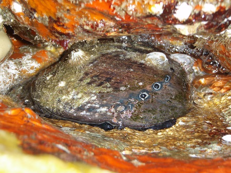
From 2012 to 2015, GFNMS worked with National Marine Fisheries Service, Tenera Environmental, USFW, and California Academy of Sciences to explore and map locations and document habitat quality of the endangered black abalone (Haliotis cracherodii) on the South Farallon Islands. View Report (PDF, 1.9Mb). In summary, no black abalones were found and there are indications that black abalone are occasionally found of the islands but were never highly abundant. The habitat characterization found prevalent rock crevices of potentially suitable habitat for black abalone, but most were densely colonized with sessile invertebrates (e.g., mussels, sea urchins, anemones, tunicates, sponges, barnacles, tube worms, hydroids, bryozoans). Any black abalone recovery efforts and potential for success on the Farallon Islands will be faced with many challenges, consisting of biological constraints, logistics constraints, and permit requirements. Rock crevices would need to be cleared of sessile invertebrates and possibly maintained for outplanting individuals and to provide open spaces for larval recruitment. Algal food supplies could be limiting.
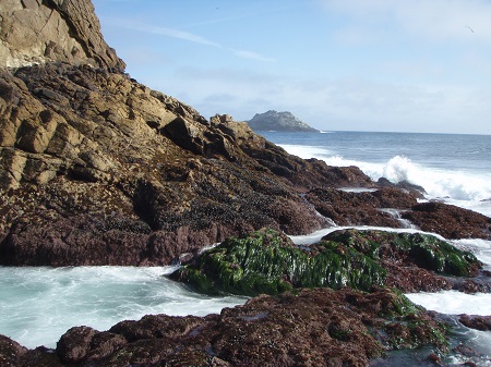
Natural resource managers use rocky intertidal data to determine the level and timing of restoration activities, to determine if new education programs to reduce trampling are needed, and to assess the need for new regulatory actions. The long-term data are "banked" into information "savings accounts." This information can later be "withdrawn" and used to determine the extent and damage from events such as oil spills and vessel groundings. Intertidal monitoring can also track shifts in sea level rise, impacts from increased storm events, freshwater inundation, and shifts in species ranges, distribution and abundance. The pristine, rocky intertidal areas at the Farallon Islands are far-removed from the coastal pressures and impacts found along the mainland – such as trampling and the collection of organisms, chronic oil pollution, contaminated water from streams and culverts, and other pressures from urbanization. Thus, researchers use the data from the pristine rocky intertidal communities at the Farallon Islands to assess the level of human-impacts to and pressures on similar rocky intertidal communities along the mainland.
View the live webcam at the Farallon Islands