Maps
Sanctuary Boundaries
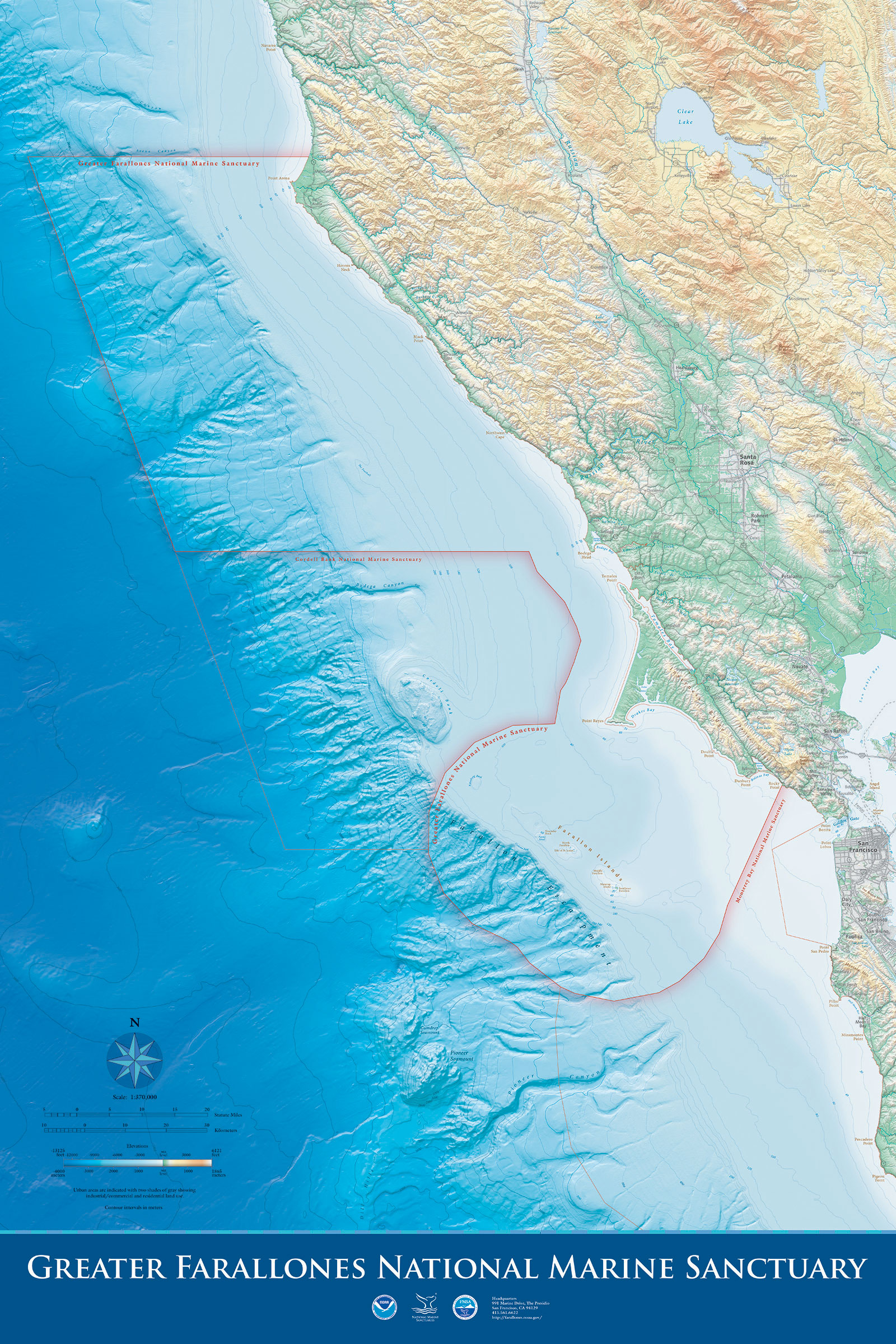
GFNMS Atlas
An atlas of Greater Farallones National Marine Sanctuary, featuring bathymetric and topographic information. Note: this map is intended to be printed as a 16.66 x 25 inch poster.
This map is provided for your personal and educational use.
Download GFNMS Atlas (1.03 MB)
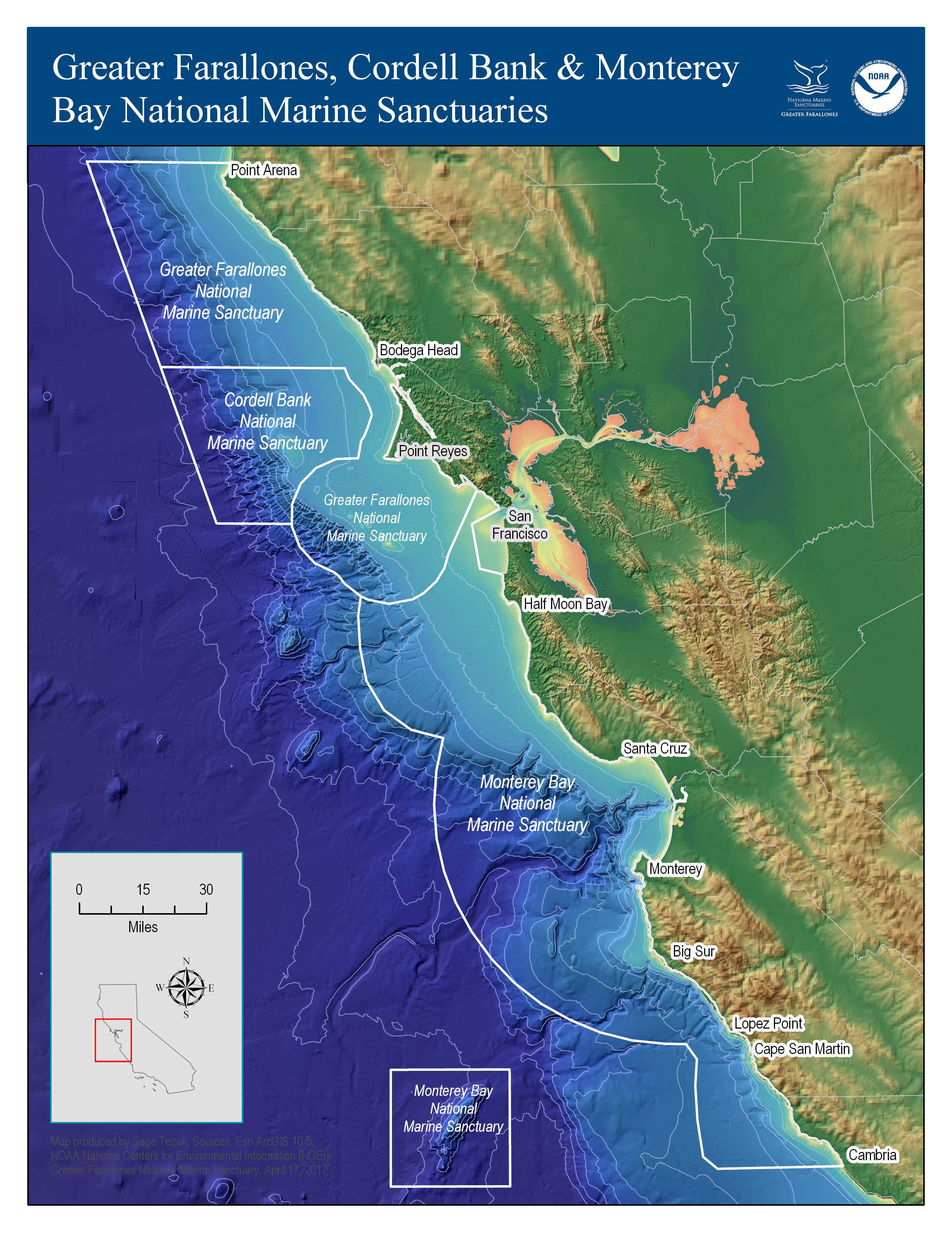
Central California National Marine Sanctuaries
Three contiguous national marine sanctuaries off the central California coast.
Download Central California NMS Map (1.28 MB)
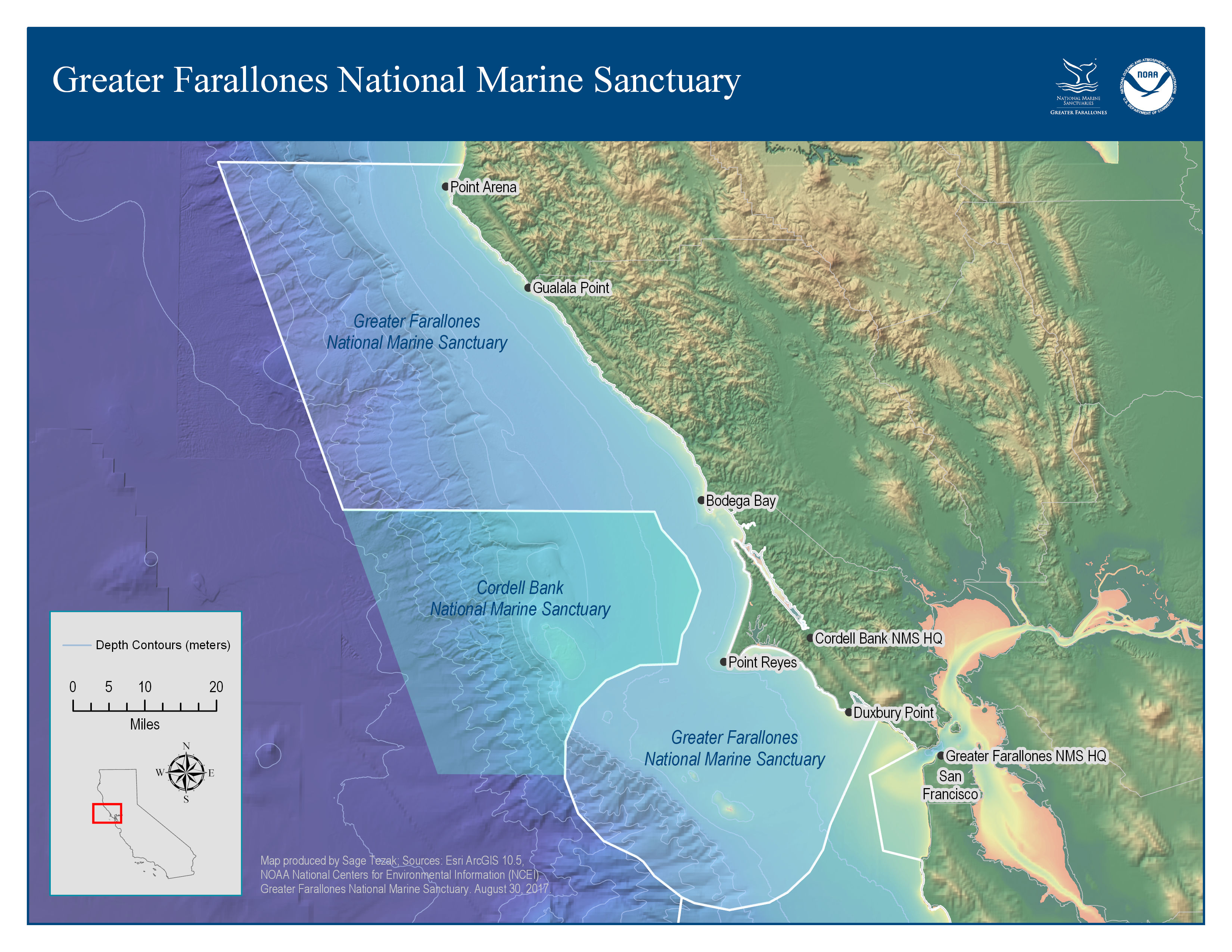
Greater Farallones National Marine Sanctuary
Color map of the sanctuary showing color-tinted hillshade and bathymetric features. This base layer is provided by NOAA National Centers for Environmental Information (NCEI).
Download GFNMS Map (700 kb)

Management Area of Greater Farallones and Cordell Bank national marine sanctuaries
Download Management Area Map (878 kb)
Regulatory Zones
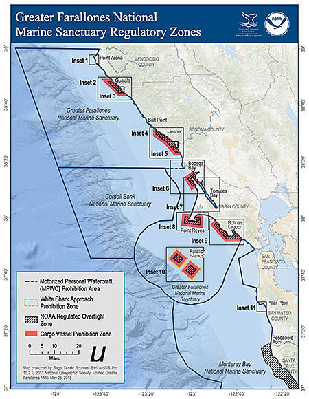
Regulatory Zones of Greater Farallones National Marine Sanctuary
This map shows all regulatory zones within Greater Farallones National Marine Sanctuary. To view detailed information on each inset, click on the inset labels (Inset 1 – Inset 11)
Download Regulatory Zones Map (25.2 MB)
Monitoring & Data Collection
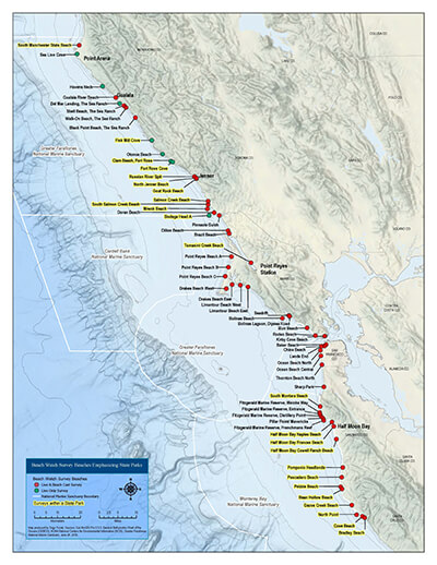
Beach Watch Actively Surveyed Beaches
Beach Watch is a long-term, volunteer citizen science monitoring program that helps protect and understand our coastal resources. This map shows actively surveyed beach segments. Learn more about the Beach Watch Program.
Download (3.27 MB)
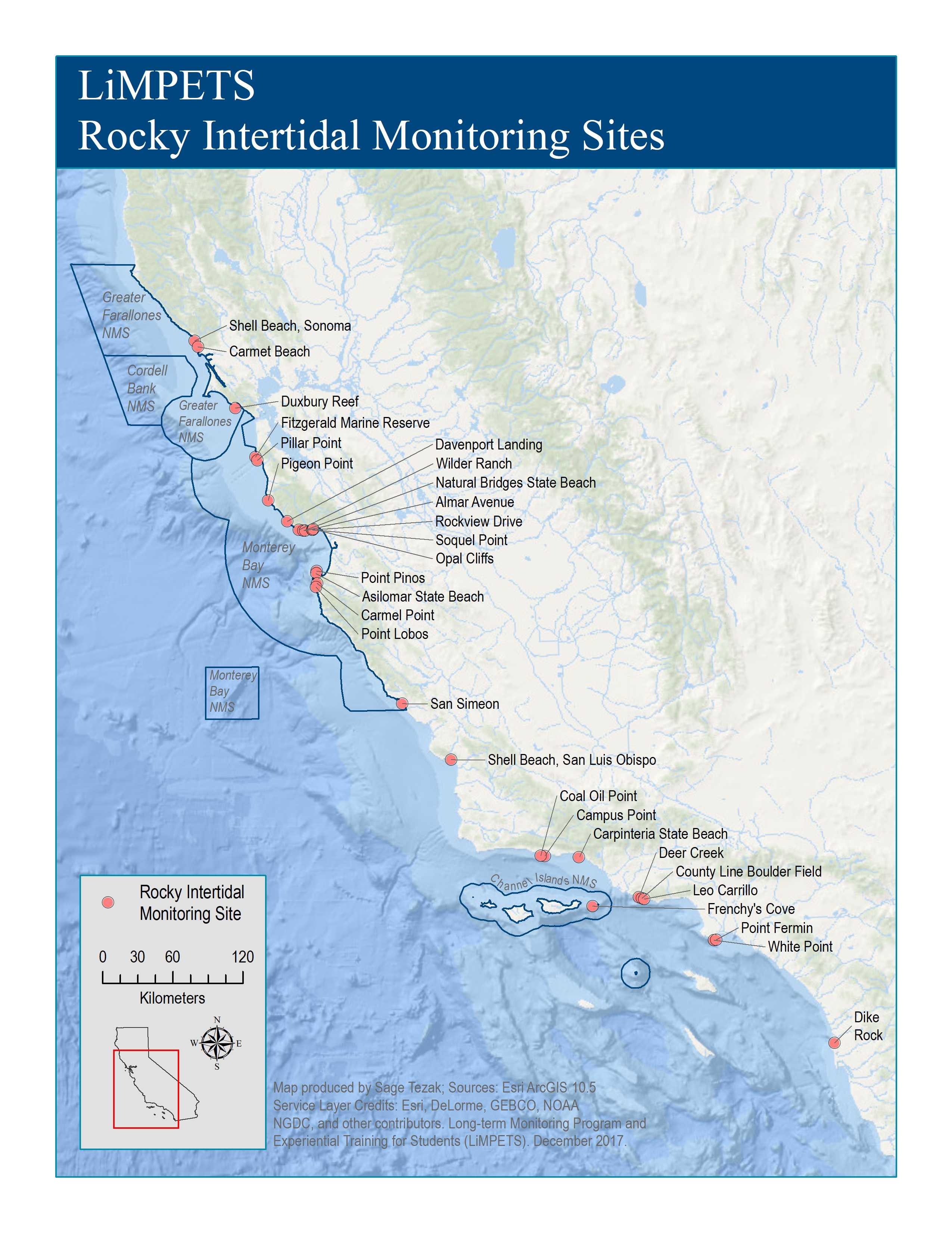
LiMPETS Intertidal Monitoring Sites
The Rocky Intertidal Monitoring Program is an in-depth education and citizen science monitoring program for high school students, educators, and volunteer groups.
Our participants are trained to survey key invertebrate and algal species at established monitoring sites along the coast of California. Learn how to get involved with this program.
Download (3.13 MB)
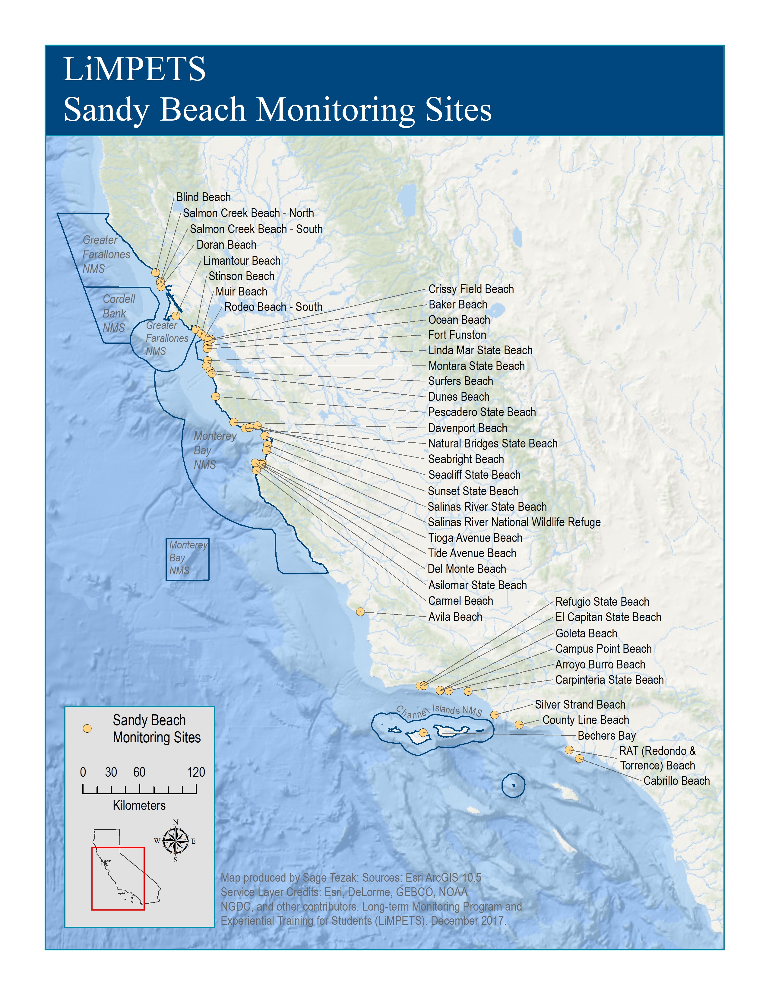
LiMPETS Sandy Beach Monitoring Sites
The Sandy Beach Monitoring Program is an in-depth education and monitoring program for middle and high school students, educators, and volunteer groups.
Participants are trained to survey the distribution and abundance of the Pacific mole crab (Emerita analoga) at monitoring sites along the coast of California. Learn how to get involved with this program.
Download (3.13 MB)