Places to Go
Greater Farallones National Marine Sanctuary staff compiled a sample of their favorite places to visit and explore in the sanctuary. Traveling from north to south along our coast, these Farallones Favorites will help you plan your trip to special beaches, rocky shores, lagoons, and estuaries with tips and ideas to guide your explorations!
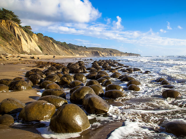
Bowling Ball Beach
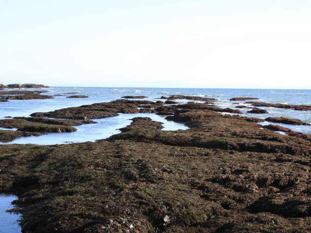
About three miles south of the town of Point Arena, follow the coastal bluff trail to Bowling Ball Beach north of Schooner Gulch State Beach. Exposed during low tides unique geologic features -- large sandstone orbs called concretions -- have earned Bowling Ball Beach its name.
County: Mendocino
Nearest Town: Point Arena, CA
Special Notes: Before you go check the park service website for trail status.
Salt Point
Salt Point State Park lies along the Sonoma coast north of Jenner and the Russian River, and south of Sea Ranch. Along the park's six miles of rugged coastline you will find 20 miles of hiking trails, Gerstle Cove Marine Reserve, fantastic spots for picnicking, hiking, horseback riding, fishing, skin and SCUBA diving. Make a weekend of it by overnighting at one of the campsites, or more comfy Sea Ranch or Gualala accommodations.
County: Sonoma
Nearest Town: Between Jenner & Sea Ranch, CA
Special Notes: If you are going to camp, be sure to make reservations!

Estero Americano Coast Preserve
A few miles south of the coastal town of Bodega Bay, the trails at the Estero Americano Preserve offer sweeping vistas and views of Greater Farallones National Marine Sanctuary that span iconic coastal features such as Point Reyes, Hog Island, Tomales Bay, Doran Beach, Estero Americano, Bodega Rock, and Bodega Head while having a 360 view of the land east of the coast.
County: Sonoma
Nearest Town: Bodega Bay, CA
Special Notes: Before you go check the Coast Preserve website for where to park, trail status and hours of operation.
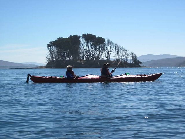
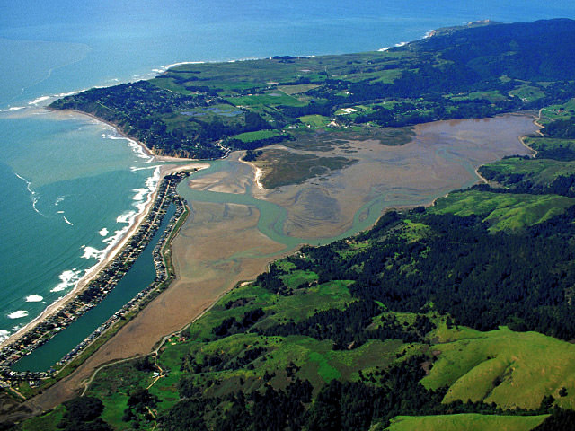
Tomales Bay
Tomales Bay boasts a variety of habitats for a wide range of sanctuary adventures: boating, kayaking, swimming, seal-watching, fishing, birding and clamming. Round out your visit with a scenic hike, and a picnic provisioned at nearby Pt. Reyes Station. Overnight at a rustic B↦B.
County: Marin
Nearest Town: Inverness/Marshall, CA
Special Notes: Bring binoculars or spotting scope. Dress in layers, as weather and fog conditions all along the coast can change in minutes.
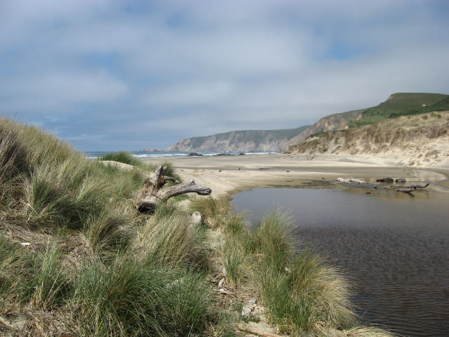
The Great Beach
Also known as Point Reyes Beach, this is where the mighty (but mis-named) Pacific hurls itself at the continent's edge; the term "majestic" doesn't do it justice. This unbroken 11-mile stretch of coast is home to sea- and shorebirds, including Snowy Plovers and other coastal wildlife. Bracing salt air, endless vistas and a sense of infinity await you!
County: Marin
Nearest Town: Point Reyes, CA
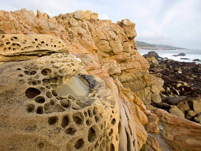
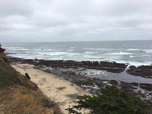
Duxbury Reef
Duxbury Reef/Agate Beach Park is not only home to a large diversity of marine invertebrates and algae, it is among the largest shale reefs in North America. Agate pebbles of all shapes and sorts sparkle in the sun and surf. There are no directional signs, but a GPS or a chat with a local can set you on the right path. Duxbury reef is a State of California Marine Conservation Area, check regulations before you go.
County: Marin
Nearest Town: Bolinas, CA
Special Notes: Check the tides before you go!
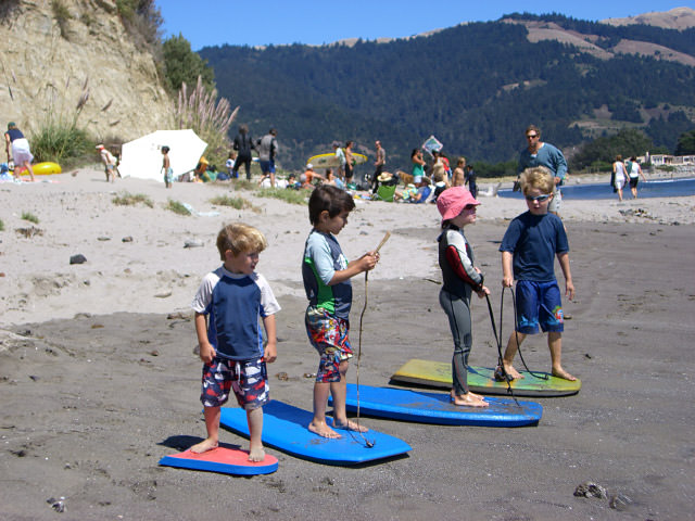
Bolinas Beach
Locals keep removing directional signs, but a visit to Bolinas is worth the search! Hint: Use your GPS. A short drive off Hwy. 1, and about 4.5 miles north of Stinson Beach, Bolinas boasts two public beaches, a quaint downtown with a cafe, grocery store, surf shop, art gallery, and the oldest saloon west of the Mississippi! This is a great spot to learn to surf; surfboard rentals and lessons are available locally.
County: Marin
Nearest Town: Bolinas, CA
Bolinas Lagoon
Part of the Pacific Flyway, this 1,100 acre tidal estuary nestled between Stinson Beach and Bolinas is a wildlife preserve and home to a profusion of birds, invertebrates and waterfowl. Audubon Canyon Ranch's egret "heronries" above the lagoon are world famous. Enjoy strolling, kayaking and wildlife viewing: Look for harbor seals at low tide!
County: Marin
Nearest Town: Bolinas/Stinson Beach, CA
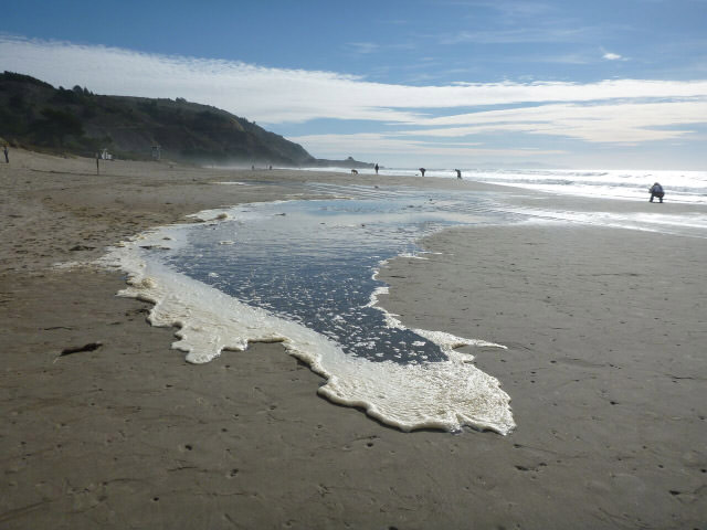
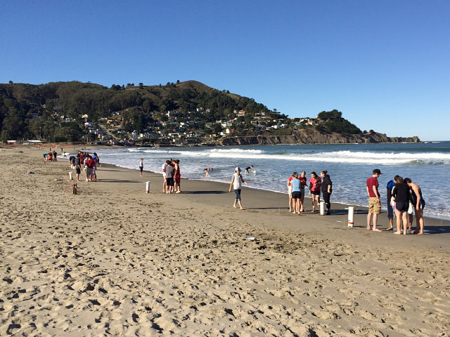
Stinson Beach
Over three miles of glistening white sandy beach, an adjacent park with picnic tables, great upland hiking trails, and a picturesque seaside town make this a great day trip or weekend getaway. Gray whales migrate nearshore in winter and spring. Restaurants, lodging, antiques, galleries and a surf shop provide a welcoming ambience. You can get here by public transit!
County: Marin
Nearest Town: Stinson Beach, CA
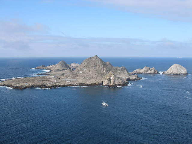
Farallon Islands
San Francisco's most exclusive neighborhood is a rocky island group 27 miles offshore, at the Farallon Islands! This U.S. Fish & Wildlife Service refuge is the largest seabird rookery in the contiguous U.S. with over 300,000 seabirds, including Tufted Puffins. It's a B&B for seals and sea lions; surrounding sanctuary waters serve up a seafood feast for humpback and blue whales, white sharks, and giant sunfish. While the public cannot land, a naturalist-led day cruise can provide an unforgettable experience.
County: San Francisco
Nearest Town: San Francisco, CA
Linda Mar Beach
Linda Mar Beach (aka Pacifica State Beach) is a beautiful crescent-shaped beach that offers great walking, beachgoing, and surfing. With gentle rolling waves and a broad, sandy beach, surfers of all skill levels ride these waves. Consider surf lessons in one of the various surf camps that operate here. In spring gray whale moms and calves may pause here to rest during their long northward journey.
County: San Mateo
Nearest Town: Pacifica, CA

Devil's Slide Trail-View of Egg Rock
Walk on the trail about five minutes from the south entrance to view rocky sea stacks about 800 feet offshore (Egg Rock) that are home to a significant breeding colony of common murres. On a clear day you can see the Farallon Islands, home to over 400,000 murres.
County: San Mateo
Nearest Town: Pacifica, CA
Special Notes: Check trail status and bring binoculars, late spring/summer are when birds are most abundant on Egg Rock.
Fitzgerald Marine Reserve
Fitzgerald Marine Reserve is one of the most spectacular, accessible and protected tidepool sites along the northern California coast. Stalk the elusive octopus, the scurrying sculpin, the bristly urchin, the bat sea star. Check the tides before you go: a 0-foot or minus tide is best! Group reservations required.
County: San Mateo
Nearest Town: Moss Beach, CA
Special Notes: You must have a reservation for groups of 10 or more!
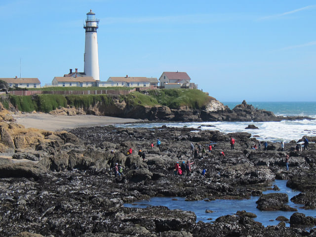
Pigeon Point Lighthouse & Reef
The 115-foot tall Pigeon Point Lighthouse is a California Historical Landmark perched atop a rocky promontory jutting into the sea. It's visitor center recounts our maritime heritage: indigenous peoples, European exploration and conquest, and shipwrecks. Overnight at the hostel (luxuriate in the cliffside hot tub!) or a nearby B&B. Join a ranger-led history walk, explore coastal trails, or investigate tidepools teeming with curious sea creatures. Something for everyone at this stop!
County: San Mateo
Nearest Town: Pescadero, CA
Special Notes: