Doghole Port: Bihler Landing
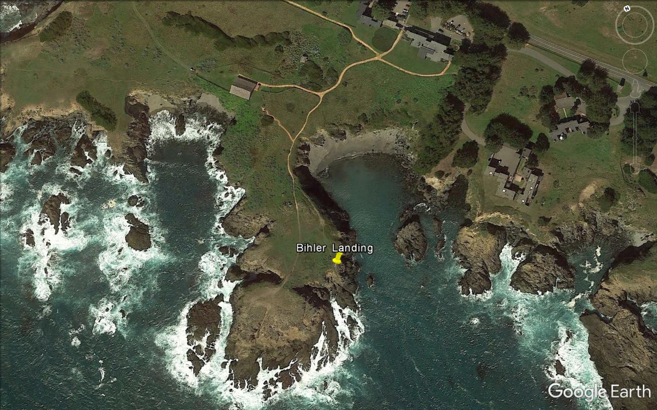
The yellow pin denotes the location of a slide chute at Bihler Landing. (Credit: Google Earth)
Like much of northern Sonoma County, the land upon which Bihler Landing developed was first acquired by German-born, and naturalized Mexican citizen, Ernest Rufus as part of the Rancho De Hermann, or German Rancho, in 1845. Rather than settling the land himself, Rufus engaged Frederick Hugal to move to the area, and he began farming and ranching the land around Bihler Landing, thus securing Rufus’ claim. Hugal’s ranching operation passed to fellow German immigrant William Bihler in the 1850s, who continued livestock ranching in the area until 1860 when his nephews Christian Stengel and Adam Knipp began managing the operations. While Stengel and Knipp focused on ranching, Bihler sought to take advantage of his timber resources with lumbering and milling operations in the 1860s and 1870s.
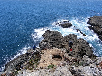
By 1875, Bihler and D. B. L. Ross built a landing with a slide chute and then expanded with a second slide chute a year later. They shipped out produce, tan bark, posts, firewood, staves, and railroad ties. Even though the doghole port had two chutes, only the outer one was used. Ultimately Knipp and Stengel purchased 3220 acres from Bihler before selling to the brothers William and George Bender in 1904 as the timber industry was declining. A wire chute eventually replaced the older slide chutes around the turn of the 20th century, and the doghole port operated until 1917. Photographs of the doghole port during this later period show the wire chute perched on the bluff edge with an accompanying warehouse nearby.
The Bihler Landing doghole port was just south of the Black Point community, which arose as the milling operations associated with the chutes prospered. The buildings, over a dozen in number, included a barn, hotel, store, post office, blacksmith shop, wagon shop, and livery. A survey of the coast in 1879 by the U.S. Coast and Geodetic Survey revealed two slide chutes on the cove’s northwestern side as well as a network of access roads.
Bihler Landing is located on private property, owned by The Sea Ranch Association, but is accessible to the public through the California Coastal Trail. The doghole port lies on the coastal bluff seaward of The Sea Ranch Lodge. Archeologists documented a variety of features at the site including iron pins, bolts, and eye bolts along with rebates in the rocks for the chute legs and a depression at the wire chute’s location. While today it is the scenic beauty that captivates the public while seeking solitude at Bihler Landing, not long ago the area was an active doghole port filled with the hustle and bustle of business transactions, moving lumber, and loading ships.
-- Deborah Marx, Maritime Archaeologist, Maritime Heritage Program, Office of National Marine Sanctuaries

A two-masted schooner moored off Bihler Landing’s wire chute.
Credit: Fort Ross Conservancy
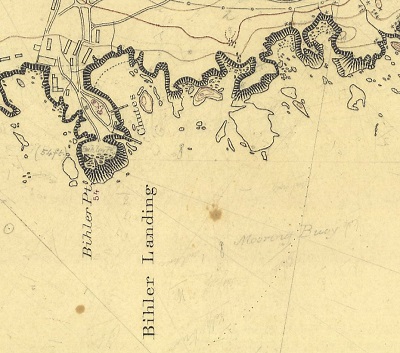
The U.S. Coast and Geodetic Survey T-sheet from 1879 depicts two lumber chutes at Bihler Landing.
Credit: NOAA’s Historical Map & Chart Collection
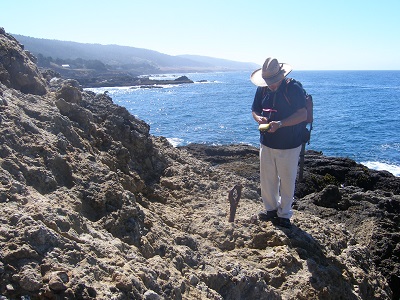
CA State Parks archaeologist Scott Green records the location of an iron eye bolt.
Credit: NOAA ONMS and California State Parks

An iron pin (left) and eye bolt (right with the blue flag) are two of many port infrastructure remnants present in the cliff face.
Credit: NOAA ONMS and California State Parks
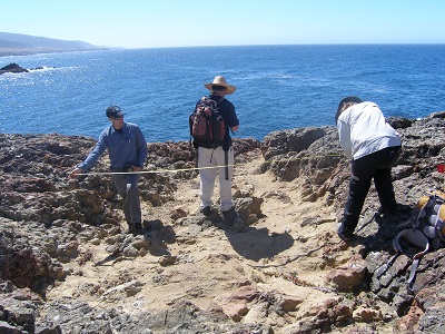
Archaeologists measure a flattened area possibly associated with the wire chute loading area.
Credit: NOAA ONMS and California State Parks
A circular rebate that once held a slide chute’s wooden support leg.
Credit: NOAA ONMS and California State Parks
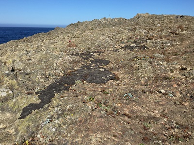
Evidence of maritime activity at Bihler Landing includes this tar spill on top of the cliff.
Credit: NOAA ONMS and California State Parks

View east from Bihler Landing’s doghole port toward the Sea Ranch Lodge.
Credit: NOAA ONMS and California State Parks
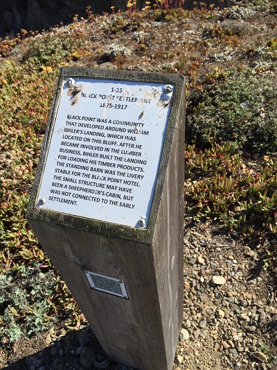
The Sea Ranch historical marker 1-25 describes the history of Bihler Landing and the Black Point settlement.
Credit: NOAA ONMS and California State Parks