Doghole Port: Del Mar Landing
Euro-American activity at this location began in 1849, when Charles Meyer and William Benitz established a landing at a small protected cove cut into the very rocky coastline. The partners shipped out produce and grain until losing the Rancho in 1855. Almost half a century passed before large scale lumbering activities arrived on the scene. Slightly south of the original landing cove on a projecting lobe of the coast, brothers William and George Bender built a mill and installed a wire chute in 1898 naming the doghole port Del Mar Landing. By 1903, they had expanded their enterprise by building a saloon, store, and warehouse for drying and storing milled lumber. The mill burned down in 1910, and the wire chute was likely abandoned shortly thereafter.
While a 1917 edition of the U.S. Coast Pilot for the Pacific Coast notes that Del Mar Landing had a wire cable for loading, U.S. Coast and Geodetic Survey cartographers did not draw a wire chute on their 1929 map of the area. As a result of its short operational time span, the wire chute at Del Mar Landing is sparsely documented in the historical record. When operational, tan bark and split stakes were some of the timber products shipped from the port. Unlike other doghole ports in the area, the natural topography offered no protection for vessels loading at Del Mar. As timber resources diminished in the area, there was little reason to continue use of the sub-optimal port.
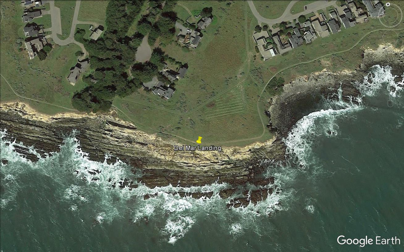
Del Mar Landing is located on private property, owned by The Sea Ranch Association, but it is accessible to the public through the California Coastal Trail. The doghole port is located between trail post 58 and 59. There are few extant archaeological remains along this stretch of coastline due to its exposed location and coastal bluff erosion. Just seaward of the coastal trail, a large wooden timber protrudes from the bluff. Bracketing this timber are several iron eyebolts and rings set into the rocks. These artifacts once secured the wire chute in place and prevented it from toppling into the ocean under a heavy timber load.
-- Deborah Marx, Maritime Archaeologist, Maritime Heritage Program, Office of National Marine Sanctuaries
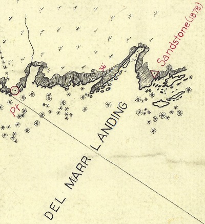
The U.S. Coast and Geodetic Survey T-sheet from 1929 indicates the location of Del Mar Landing.
Credit: NOAA’s Historical Map & Chart Collection
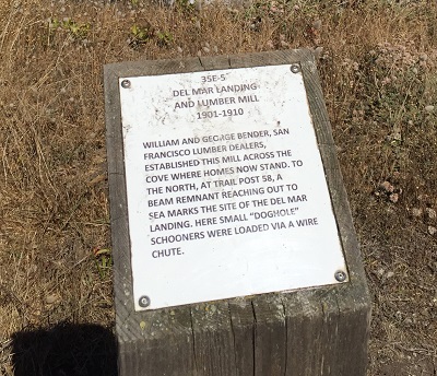
The Sea Ranch historical marker 35E-5 interprets the history of Del Mar Landing and is located just south of the doghole port.
Credit: NOAA ONMS and California State Parks
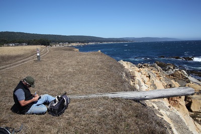
California State Parks archaeologist Richard Fitzgerald takes notes on a wooden beam associated with the wire chute once located at Del Mar Landing.
Credit: NOAA ONMS and California State Parks
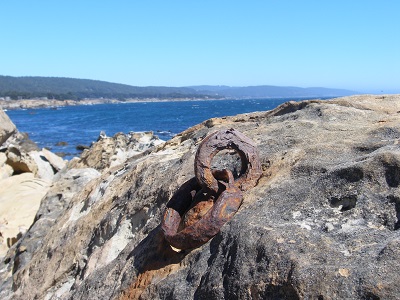
Despite being exposed to the elements, these iron rings are in excellent shape and provide evidence for where ships loaded lumber cargos.
Credit: NOAA ONMS and California State Parks
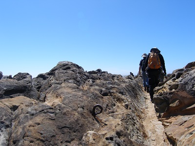
Archaeologists conduct a walking survey to record the doghole port features such as this eye bolt.
Credit: NOAA ONMS and California State Parks
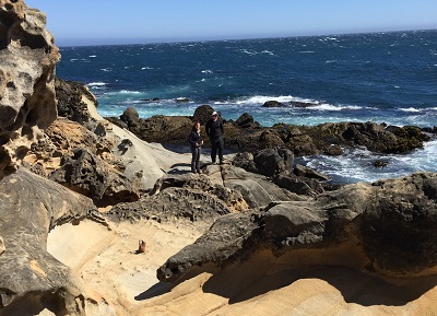
Del Mar Landing was not an ideal doghole port due to little protection provided from heavy sea conditions.
Credit: NOAA ONMS and California State Parks