Modified Shipping Lanes

Large ships traveling in and out of San Francisco Bay are strongly encouraged to travel according to the traffic separation scheme, or 'TSS,' in specified shipping lanes for safety. NOAA's ONMS worked closely with the United States Coast Guard to recommend modifications to Bay Area shipping lanes. Effective June 1, 2013, SF TSS adjusted to balance the safe and efficient flow of commerce within and between our nation's ports and included NOAA's goal to reduce the overlap of whales and ships. The modifications extended the east-west shipping lanes several miles further westward, directing ships away from known high-density feeding whale aggregation sites in the sanctuaries.
Research and Monitoring
Since 2004, Cordell Bank and Greater Farallones national marine sanctuaries, in partnership with Point Blue Conservation Science, have been conducting at-sea surveys in a program called Applied California Current Ecosystem Studies (ACCESS). ACCESS surveys monitor marine wildlife distribution and abundance (including seabirds, blue and humpback whales), prey abundance, and associated ocean conditions. These data are essential for helping sanctuary staff better understand the importance of sanctuaries to endangered whales. Data help inform management actions, including reducing ship strike and entanglement risk to whales.
Whale Alert
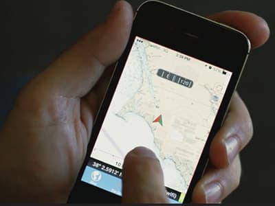
National marine sanctuaries on the West Coast helped develop Whale Alert and Spotter Pro, mobile applications that allow field researchers, whale watch naturalists, fishing captains, and other boaters to report whale sightings. The crowd-sourced data are incorporated into ongoing risk assessments to help reduce whale entanglements and ship strikes. The public can share sightings on theWhale Alert app, learn safe boating around whales, identify marine mammals, and see other active regions reporting sightings here.
Explore the San Francisco Region sightings from Point Blue Conservation Science scientists on the Farallon Islands and boat-based naturalist observations. To sign up for sightings updates, follow this link Whale ALERT - West Coast list.