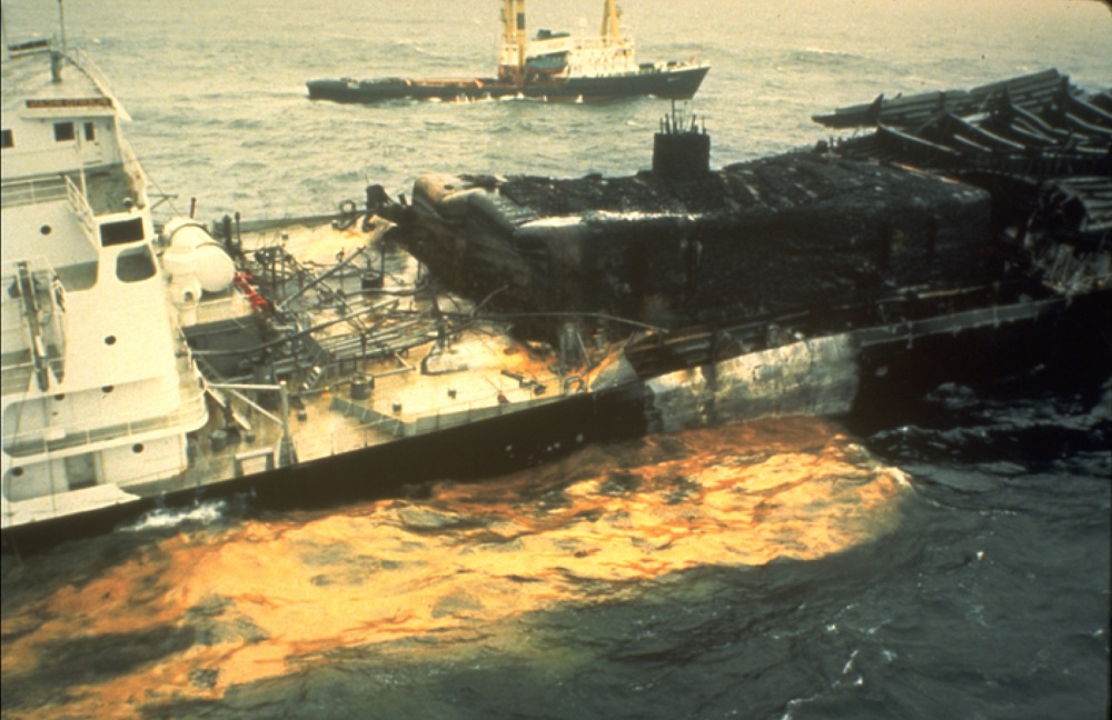
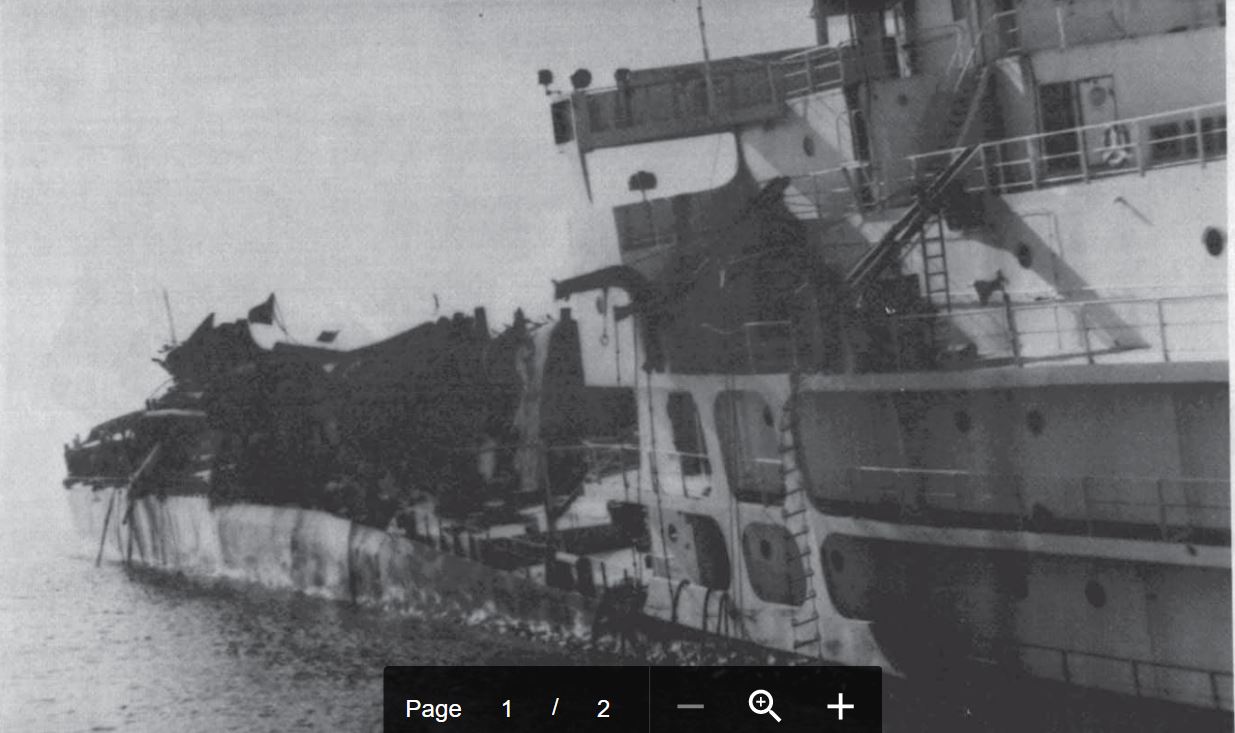
Tanker Vessel Puerto Rican at sea with severe hull damage following the explosion and fire.
Credit: Michael Herz, San Francisco Baykeeper
Casualty Narrative*
The Puerto Rican was a modern steel tanker over six hundred feet long. It arrived in San Francisco Bay on October 25, 1984, under Master James C. Spillane, and called at Richmond and Alameda. It loaded a cargo of 91,984 barrels (3,863,328 gallons) of lubrication oil and additives, took on 8,500 barrels (357,000 gallons) of bunker fuel, and departed for sea shortly after midnight on October 31, bound for New Orleans. At 3:24 a.m., as the tanker was disembarking the pilot boat outside the San Francisco Bay Entrance Channel, an explosion occurred near the No. 6 center-independent tank, which blew flames several hundred feet into the air, knocked the pilot and two crew members into the water, and folded back an immense section of the deck measuring nearly 100 feet square. The pilot boat San Francisco rescued Pilot James S. Nolan and Third Mate Philip R. Lempiere, but Able Seaman John Peng was lost.
Response by the U.S. Coast Guard was immediate, and the burning tanker was towed to sea in order to minimize the chance of a disastrous oil spill on the sensitive areas of San Francisco Bay, the adjacent ocean shoreline, and the Point Reyes - Farallon Islands National Marine Sanctuary (now Greater Farallones NMS). By the following afternoon the fires had been extinguished, but on November 3, 1984 the weakened hull broke in two sections, releasing 25,000- 35,000 barrels (1,050,000 - 1,470,000 gallons) of oil into the water. Although the oil initially moved south after the breakup, on the third night it reversed trajectory, first encircling the Farallon Islands then coming ashore at Bodega Bay and Bodega Harbor.
The stern of the Puerto Rican sank with a maximum of 12,500 barrels (525,000 gallons) of lubricating oil as cargo, and 8,500 barrels (357,000 gallons) of bunker fuel oil. Eighteen days after the explosion, the bow section was towed back to San Francisco Bay and its cargo safely unloaded without incident. During the response, approximately 1,500 barrels (63,000 gallons) of emulsified oil were skimmed from the ocean and Bodega Bay, representing less than 5% of the total released with the initial spill. Total bird mortalities from the spill have been placed as high as 5,000.
Today, the stern of the Puerto Rican sits at a depth of 1,148 feet. It was first surveyed by the U.S Geological Survey in 1985 using a side-scan sonar. In 2011, the NOAA R/V Okeanos Explorer conducted a multibeam sonar survey of the wreck site.
*The narrative is derived from the Puerto Rican Risk Assessment, Sanctuary Condition Report, Analysis of the Puerto Rican Tanker Incident, and Shipwrecks at the Golden Gate (Delgado/Haller). Although the quantity estimates differ slightly in each document, they fall within a very narrow range.
Risk Assessment
The tanker Puerto Rican, which exploded and sank off the Golden Gate, San Francisco in 1984, was identified as a potential pollution threat, thus a screening-level risk assessment was conducted. The different sections of the Risk Assessment summarize:
- what is known about the wreck,
- results of environmental impact modeling composed of different release scenarios,
- ecological and socioeconomic resources that would be at risk in the event of releases,
- screening-level risk scoring results,
- overall risk assessment, and
- recommendations for assessment, monitoring, or remediation.
Based on this screening-level assessment, NOAA recommends that this wreck site be reflected within the Area Contingency Plans so that, if a mystery spill is reported in the general area, this vessel could be investigated as a source. It should be considered for further assessment to determine the vessel condition, amount of oil onboard, and feasibility of oil removal action. The sanctuary Beach Watch (BW) program collects tarball found during BW surveys and works with the state Office of Spill Prevention and Response to identify the source(s) of tarballs. An active monitoring program of the shipwreck itself should be implemented. Outreach efforts with commercial and recreational fishermen who frequent the area would be helpful to gain awareness of changes in the site.
Damage Assessment
After an accident like this takes place, very often the responsible party is required to pay for damages to the nation's natural and cultural resources and lost recreational and commercial uses. Funds from the legal settlement for the Puerto Rican spill have been used to support sanctuary involvement in Groundfish Essential Fish Habitat (EFH) evaluation and siting of new EFH Conservation Areas; to remove grounded and abandoned vessels in sensitive sanctuary habitats; and to develop and initiate an education and stewardship program for school children, called LiMPETS. Funds have been used in Tomales Bay to assess eelgrass restoration, and remove abandoned moorings, docks and vessels.
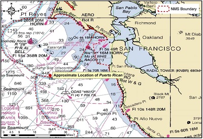
Approximate location of the shipwreck Puerto Rican's stern section.
Credit: NOAA Coast Survey
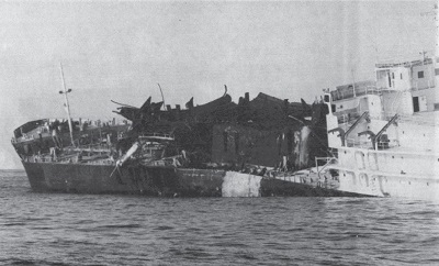
The Puerto Rican sinking on November 3, 1984.
Credit:US Coast Guard
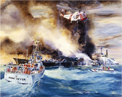
U.S. Coast Guard 82-footer Point Heyer out of San Francisco, California, hurries to assist during the Puerto Rican tanker disaster in 1984. Painting by Ralph Starr.
Credit: US Coast Guard

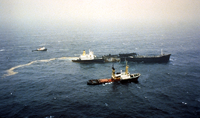
Puerto Rican under tow on November 1, 1984 at approximately 9:30 A.M. 35.5 miles off Point Bonita.
Credit: US Coast Guard
Puerto Rican under tow on November 1, 1984 at approximately 9:30 A.M.approximately 35.5 miles off Point Bonita. The swell in the foreground gives the illusion that the stern is awash. The angular difference at the gunwhale shows the area where the forebody separated from the stern on the port side of the main deck.
Credit: US Coast Guard
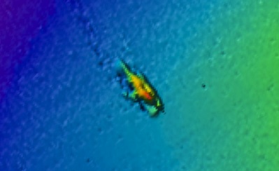
A 2-dimensional multibeam sonar image of the Puerto Rican stern reveals a depth of 1148 feet (350m) and approximate size of the wreck at 230 feet (70m) x 66 feet (20m).
Credit: NOAA R/V Okeanos Explorer Multibeam Sonar Survey 2011, processed by Gary Fabian.
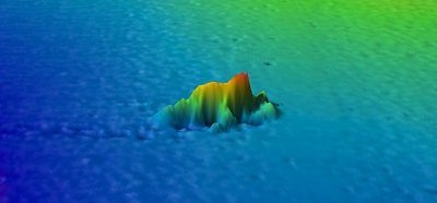
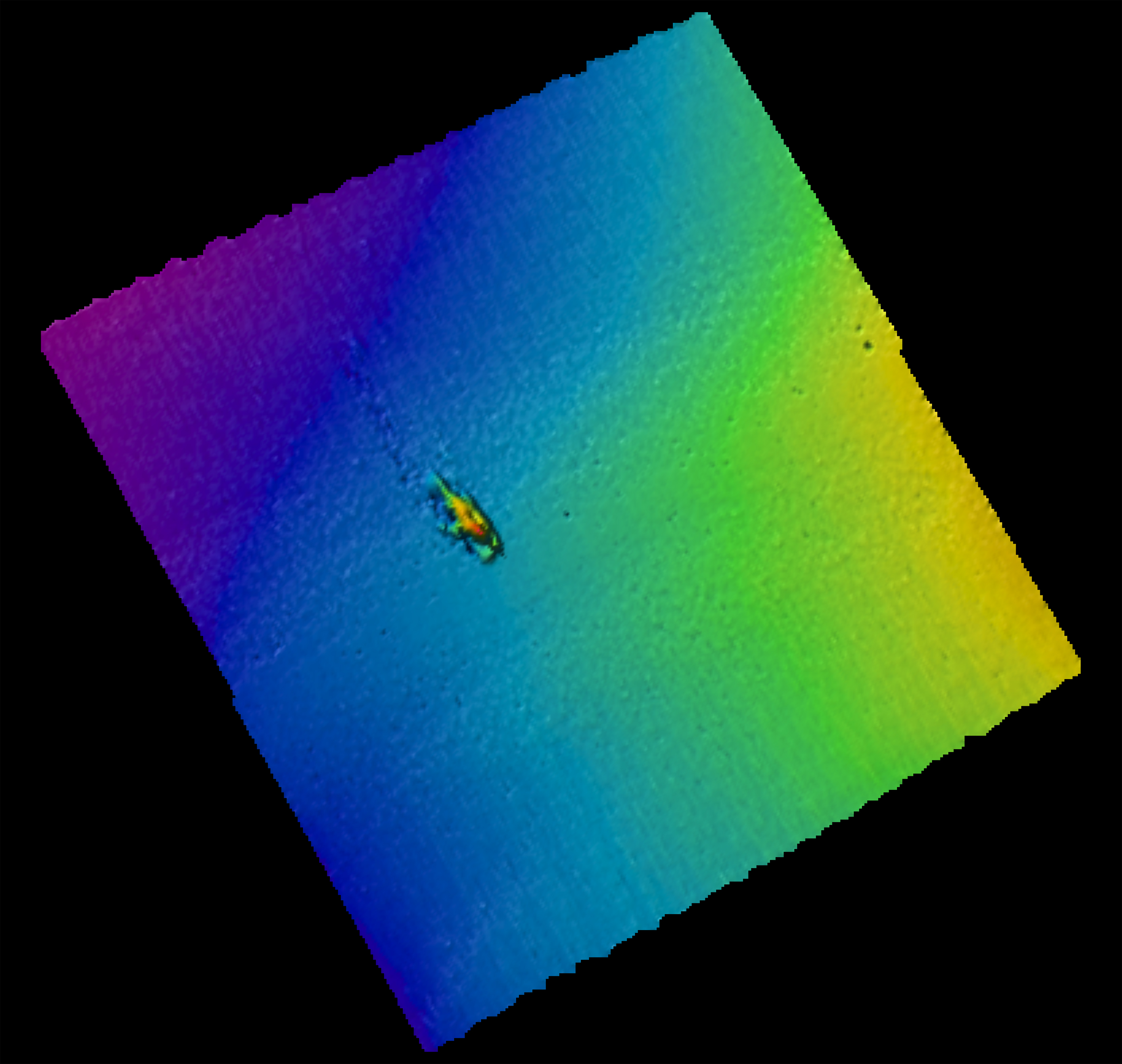
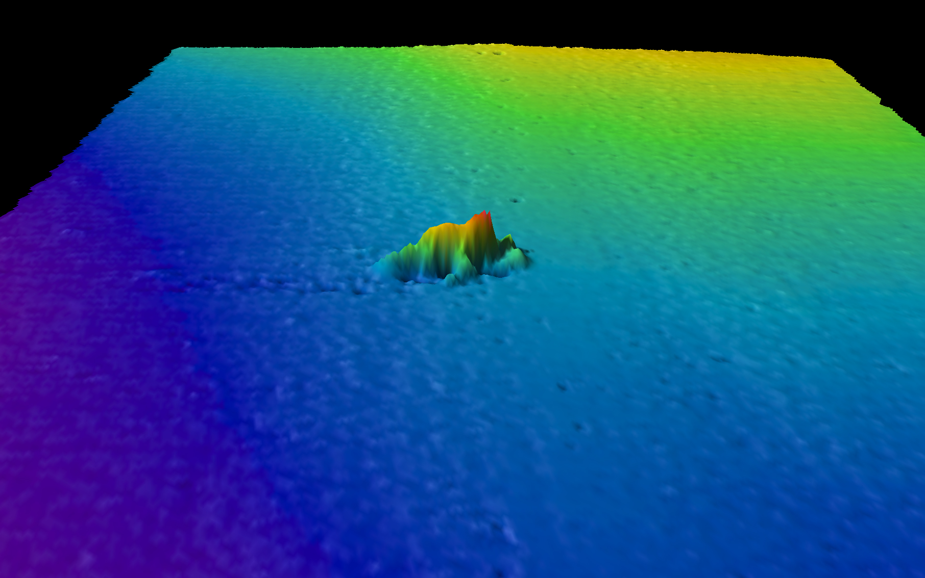
A 3-dimensional multibeam sonar image of the Puerto Rican stern.
Credit: NOAA R/V Okeanos Explorer Multibeam Sonar Survey 2011, processed by Gary Fabian.
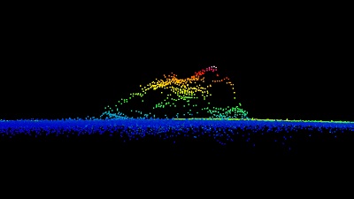
A profile points multibeam sonar image of the Puerto Rican stern.
Credit: NOAA R/V Okeanos Explorer Multibeam Sonar Survey 2011, processed by Gary Fabian.
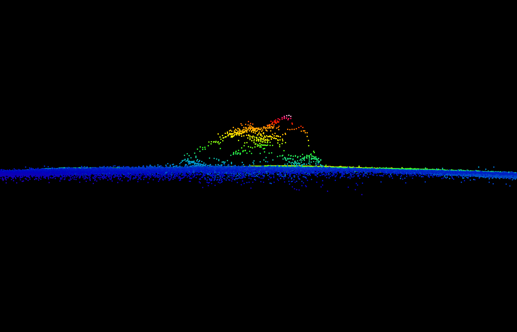