Doghole Port: Fisk Mill Cove
Salt Point State Park
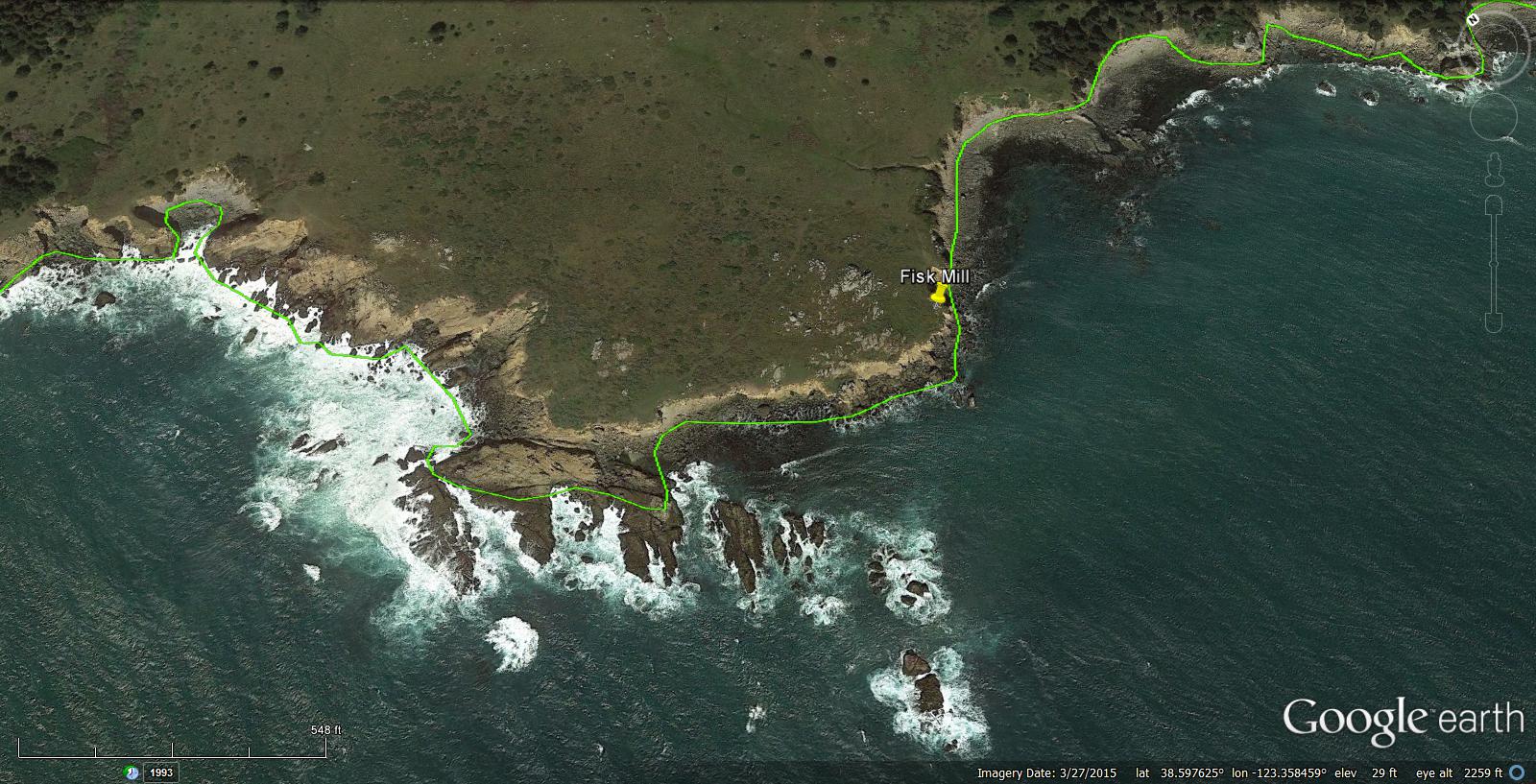
John C. Fisk began lumber and milling operations at Fisk Mill Cove in 1860 and established an active doghole port shipping out a large quantity of cord wood and tan bark. Fisk’s ownership passed to Frederick M. Helmke in 1865 who continued to run the mill before closing it in 1876. A U.S. Coast and Geodetic Survey T-sheet drawn in 1878 revealed that a lumber chute was located on the cove’s west side. Despite the adjacent mill’s closure in 1876, the chute remained active under the Kruse family, with lumber arriving for transshipment from other mills in the area such as Platt’s mill at Horseshoe Bay. Fisk Mill Cove is now part of Salt Point State Park and is well-known today for its coastal wilderness and day hiking opportunities.
Fisk Mill Cove’s doghole port past is evidenced by the archaeological remains that reside there today. One of the most unusual extant features is a wood and iron capstan standing near the main bluff. The capstan was used to move heavy items with a system of ropes and pulleys. It is possible that the capstan supported the loading or unloading of vessels in the cove, or it could also have been employed to move larger items or timbers around onshore.
As with other doghole ports, a considerable number of iron fittings have survived at Fisk Mill Cove. These fittings are some of the most durable parts of the complex engineering that went into extending a chute as much as 100 feet over water. Iron rings, bolts, and eye bolts hammered into the rock outcrops prevented the chutes from falling into the water during operation and in storms that battered the shore. Iron ring bolts also served as mooring points to keep loading vessels in place under the chute.
Due to rough sea conditions and the exposed position of this port’s lumber chute, divers were only able to conduct a single dive at Fisk Mill Cove to locate evidence of the mooring anchors. The 1878 T-sheet indicated that there were three moorings in the cove. Two moorings were situated off the lumber chute and secured the vessel while loading. The third mooring was south of the chute at the cove’s mouth and likely served as a place for schooners to tie up while waiting for the chute to become available. No anchors or other artifacts were discovered by the team during the project.
-- Deborah Marx, Maritime Archaeologist, Maritime Heritage Program, Office of National Marine Sanctuaries
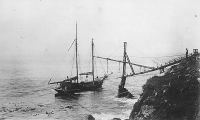
Slide chute and a waiting schooner at Fisk Mill Cove.
Credit: Fort Ross Conservancy
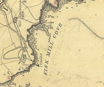
U.S. Coast and Geodetic Survey T-sheet from 1878 shows one lumber chute at Fisk Mill Cove.
Credit: NOAA’s Historical Map & Chart Collection

Andrew J. and Clara Belle Fisk’s grave marker at Fisk Mill cemetery near the cove. Andrew was John C. Fisk’s brother, and Clara was Andrew’s daughter. Both died in 1874.
Credit: NOAA ONMS and California State Parks
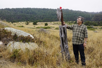
Historian Richard Everett examines a capstan present at Fisk Mill Cove used to move materials.
Credit: NOAA ONMS and California State Parks
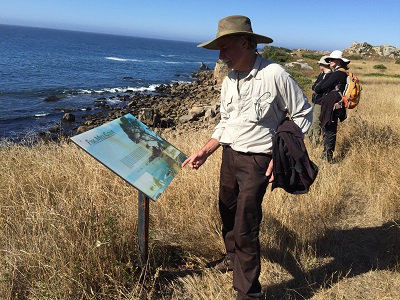
CA State Parks Geographic Information Officer Paul Veisze reviews an interpretive sign that explains Fisk Mill Cove’s lumber heritage.
Credit: NOAA ONMS and California State Parks
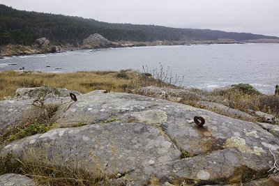
A series of iron eye bolts are positioned in the rocks to support the lumber chute.
Credit: NOAA ONMS and California State Parks
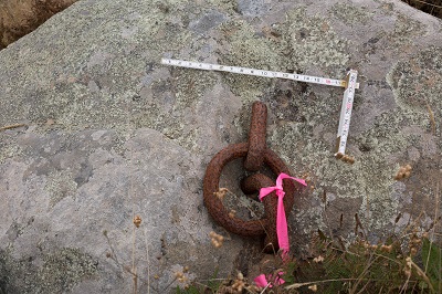
A well-preserved example of an iron ring at Fisk Mill Cove.
Credit: NOAA ONMS and California State Parks
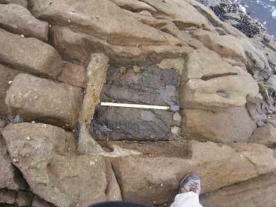
An excellent example of a square rebate cut into the rocks for the lumber chute’s leg.
Credit: NOAA ONMS and California State Parks
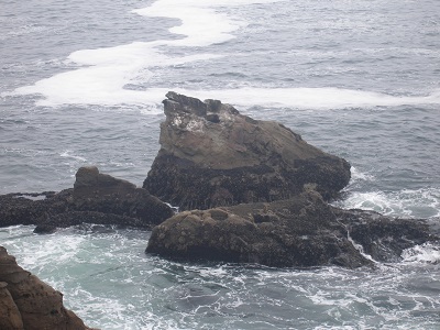
The Fisk Mill lumber chute projected far out into the cove and had additional sets of legs set into offshore rocks outcroppings. The notches for these legs can still be seen on these two rocks.
Credit: NOAA ONMS and California State Parks