Doghole Port: Gerstle Cove
Salt Point State Park
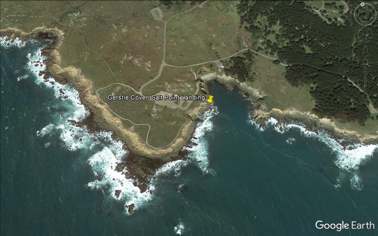
Gerstle Cove was the site of considerable economic activity as a result of stone quarrying and lumbering. The area was first developed in 1853 by Joshua Hendy and Samuel Duncan who moved a steam powered saw mill into the area becoming the first such operation in the township. Mr. Hendy sold his shares of the operation to A. Duncan, Samuel Duncan’s brother, and the two operated the mill until 1860. From that time throughout 1870s, a series of owners that included Frederick Funcke, Lewis Gerstle, and W. R. Miller operated milling, cordwood, and tanbark operations. During the early years, stone and forest products were lowered down the cliffs on cables. Eventually, lumber chutes were built there, one by William R. Miller in 1872 and a second constructed by Frederick Funcke and Wasserman. Only one chute remained by 1889, and it was abandoned by 1917 due to economic decline, the movement of lumber via railways and trucks, and the changing use of the land to ranching.
The 2016 Gerstle Cove survey investigated both land and underwater areas for archaeological remains to place the site in a larger maritime cultural landscape. Archaeologists recorded a large number of artifacts and features that illustrated quarry and lumber industry activities. Along the cove’s western bluff edge, an assortment of iron fittings (eye bolts and pins) dotted the cliff face. Rebates cut into the rocks on the foreshore revealed places where support legs held the lumber chutes projecting into deep water.
Diving surveys at Gerstle Cove located a large iron folding stock anchor at precisely the location where the 1876 T-sheet depicted a mooring buoy. The anchor’s location at the cove’s mouth suggested that it was used to hold a waiting vessel rather than one actively loading. A similar- style anchor is located at the entrance to Gerstle Cove behind the entrance booth.
-- Deborah Marx, Maritime Archaeologist, Maritime Heritage Program, Office of National Marine Sanctuaries
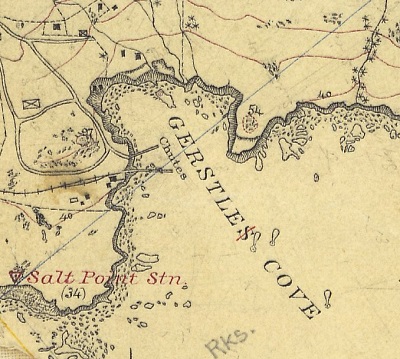
U.S. Coast and Geodetic Survey T-sheet from 1876 shows two lumber chutes at Gerstle Cove.
Credit: NOAA’s Historical Map & Chart Collection
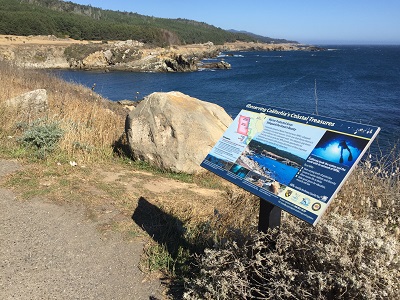
Gerstle Cove’s visitors might not be aware of its historical importance as a doghole port and the archaeological remains present there today.
Credit: NOAA ONMS and California State Parks
CA State Parks senior park aid Airielle Cathers attaches flagging tape to iron bolts set in the rocks at Gerstle Cove.
Credit: NOAA’s Historical Map & Chart Collection
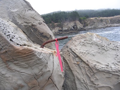
An iron eye bolt was part of the lumber chute apparatus to secure the structure to the shoreline.
Credit: NOAA ONMS and California State Parks
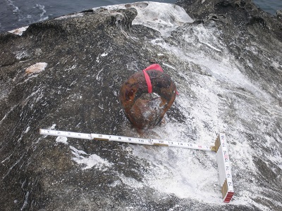
This iron pin likely secured one of the lumber chute’s support timbers to the rock.
Credit: NOAA ONMS and California State Parks
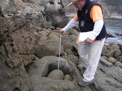
CA State Parks archaeologist Scott Green measures a cut out in the rocks where one of the large lumber chute legs sat.
Credit: NOAA ONMS and California State Parks
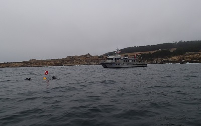
The NOAA ONMS research vessel Fulmar stands by while divers prepare to descend on a potential target in Gerstle Cove.
Credit: NOAA ONMS and CA State Parks
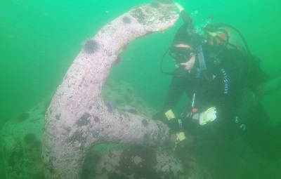
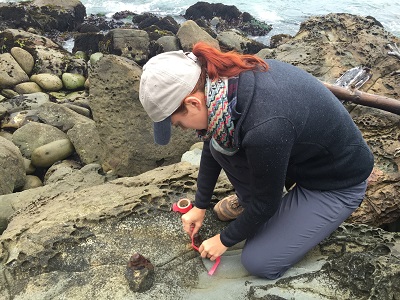
CA State Parks archaeologist Denise Jaffke records an anchor located in Gerstle Cove.
Credit: NOAA ONMS and California State Parks
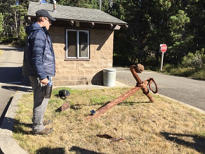
NOAA archaeologist Matthew Lawrence examines an anchor behind Gerstle Cove’s entrance booth that was reportedly taken from the cove.
Credit: NOAA ONMS and California State Parks